Groundwater has been largely unstudied in its importance and role in sustaining ecosystems.
Tag: Groundwater
Tracing the flow of water with DNA
Environmental DNA analysis of microbial communities can help us understand how a particular region’s water cycle works. Basel hydrogeologist Oliver Schilling recently used this method to examine the water cycle on Mount Fuji.
Timely study on rising groundwater offers hope for drought-stricken East Africa
New research indicates better groundwater supply management could hold the key to help combat the impact of climate change in East Africa, where countries are currently facing the worst drought and food insecurity in a generation.
Water Quality Woes in Southwest Florida Linked to Seeping Septic Systems
From fecal bacteria to blue-green algae to red tides, Southwest Florida’s water quality has declined as its population has increased. Multiple lines of evidence from a multi-year microbial source tracking study points to septic systems as a contributing source for this decline. The study is one of few to connect downstream harmful algal blooms with nutrient loading from upstream septic systems. These water quality issues are caused by aging septic systems installed in high densities in areas with shallow water tables. Septic systems may actually be sitting in groundwater during certain times of the year, which means that they cannot function properly.
Capturing Biogeochemical Details in River Corridor Models
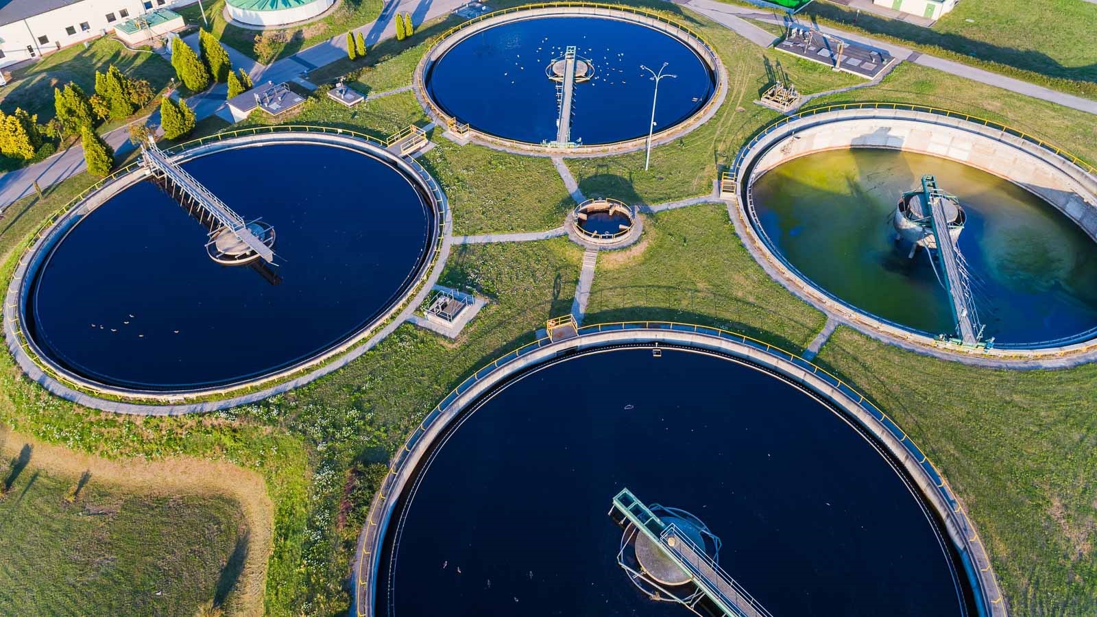
In many streams and rivers, water moves between the open channel and the adjacent groundwater, enabling reactions that can remove or transform carbon, contaminants, and nutrients. Researchers developed a new modeling strategy to represent these effects in watershed-scale models. The new model addresses current models’ limited ability to simulate how carbon, nutrients, and contaminants move and transform in river corridors and allows for a new generation of research on river networks.
Eureka! A cost effective and quick way to find groundwater in arid regions
Water is a scarce commodity in many countries worldwide, but new cost effective technology pioneered by researchers in Australia, Egypt and Saudi Arabia could ensure sustainable water supplies for decades to come.
Do depressions in Canadian prairies hold the key to groundwater recharge?
Model shows climate change may impact environment by decreasing recharge
ITEP releases report examining effects of climate change on Indigenous peoples, lands and culture
As the climate changes and land, air and water are at risk, Native Americans, Alaska Natives and other Indigenous peoples are seeing their water sources dry up and their land disappear under rising sea levels. under attack from rising global temperatures. Researchers at the Institute for Tribal Environmental Professionals brought together a diverse group of more than 100 authors to produce a first-of-its-kind report that provides an in-depth looks at what tribal nations are doing to protect against the climate crisis.
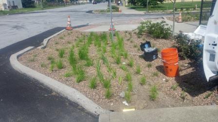
Assessing Impacts of Green Infrastructure on Groundwater Quality
Green infrastructure reduces stress on wastewater systems, decreases sewer overflows, and improves watershed health–but how does it impact groundwater quality? EPA recently completed a comprehensive multi-year study to find out. The data collected can be used by state and local…
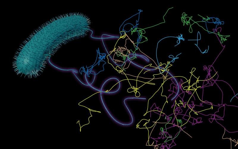
Calculating “Run and Tumble” Behavior of Bacteria in Groundwater
Bacteria in groundwater move in surprising ways. They can passively ride flowing groundwater and can actively move on their own in what scientists call “run and tumble” behavior. Scientists studied two kinds of microorganisms to improve the mathematical models that describe how bacterial run and tumble when transported by groundwater.
Argonne researchers aim to solve problems for the world’s freshwater supply
Argonne National Laboratory is partnering with industry, government, academia and others to solve problems with the nation’s water system, with wide-ranging benefits for the U.S. economy.
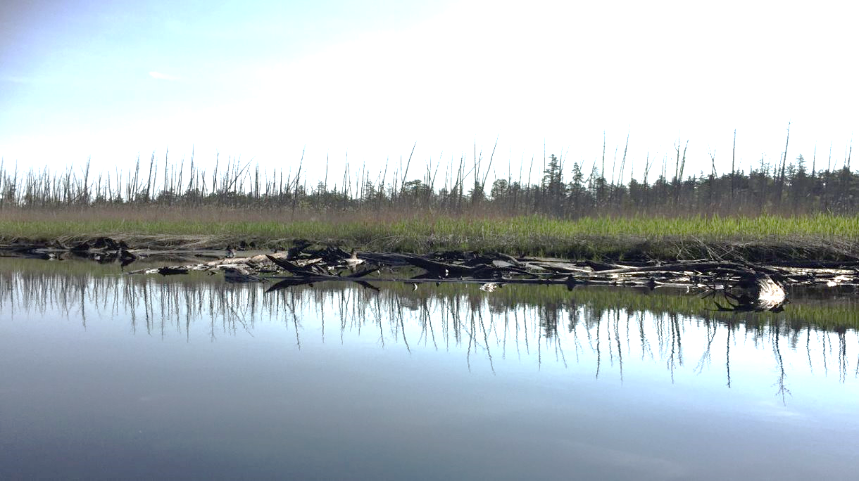
“Ghost Forests” Expanding Along Northeast U.S. Coast
Why are “ghost forests” filled with dead trees expanding along the mid-Atlantic and southern New England coast? Higher groundwater levels linked to sea-level rise and increased flooding from storm surges and very high tides are likely the most important factors, according to a Rutgers study on the impacts of climate change that suggests how to enhance land-use planning.
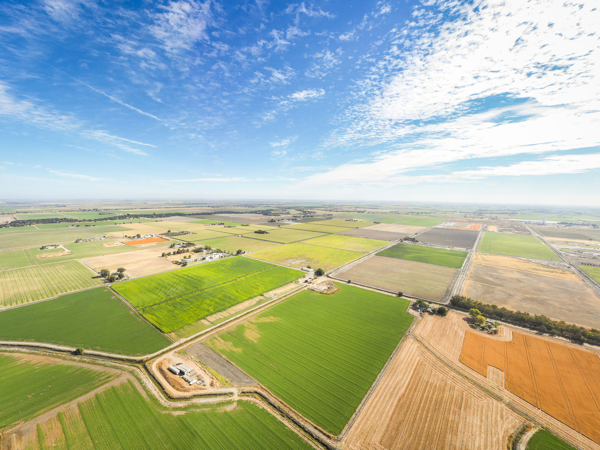
Researchers Use Satellite Imaging to Map Groundwater Use in California’s Central Valley
Researchers at the University of California San Diego report in a new study a way to improve groundwater monitoring by using a remote sensing technology (known as InSAR), in conjunction with climate and land cover data, to bridge gaps in the understanding of sustainable groundwater in California’s San Joaquin Valley.
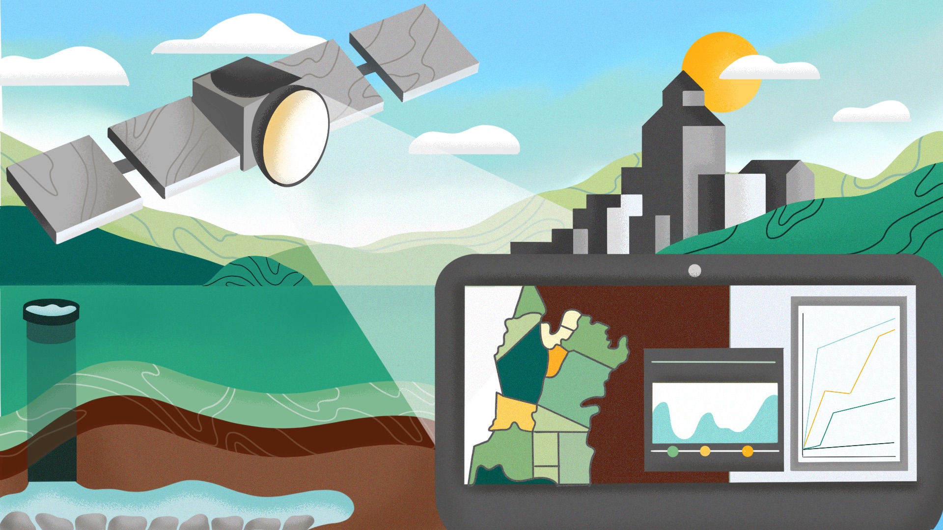
Could the Answer to Groundwater Resources Come From High in the Sky?
A new computational approach developed by scientists at Lawrence Berkeley National Laboratory offers a high-tech yet simple method for estimating groundwater: it pairs high-resolution images derived by satellite with advanced computer modeling to estimate aquifer volume change from observed ground deformation.

RESEARCH NEWS TIP SHEET: STORY IDEAS FROM JOHNS HOPKINS
The June 4, 2020, issue of the weekly Johns Hopkins Medicine research newsletter on topics NOT related to COVID19. Stories this week: study shows pollutant may be more hazardous than previously thought; psilocybin tampers the brain’s ego center; and getting urban youth to wear bike helmets.
To help students think in 3D, a geologist turns to paper model making
“Geology is a 3D science, but everything we give to students is on a 2D piece of paper,” says University at Buffalo geologist Chris Lowry, creator of the Foldable Aquifer Project. “With the foldable aquifers, students don’t have to imagine what a 2D drawing looks like in 3D.”