FAU Smart City Project Paves the Way for Forecasting COVID-19 Infection Transmission

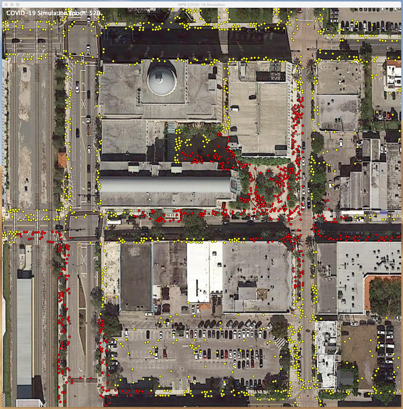
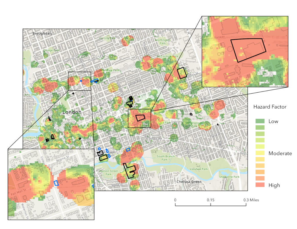
Researchers are exploring the untapped potential of emerging smart cities to enable hyper-contextualized computational epidemiology to tackle COVID-19. The idea is to partner with the computational epidemiology community to integrate evidence-based models of COVID-19 transmission with hyper-local mobility data to provide place-specific forecasts of disease transmission. When these tools are integrated into city planning efforts, they will provide real-time insights into how mobility changes within the city affect the local population’s susceptibility to future outbreaks.

Neighborhood Features and One’s Genetic Makeup Interact to Affect Cognitive Function

Few studies have examined how the neighborhood’s physical environment relates to cognition in older adults. Researchers categorized 4,716 individuals by apolipoprotein E (APOE) genotype – a genetic risk factor for Alzheimer’s disease (AD) to determine if there are cognitive benefits of living in neighborhoods with greater access to social, walking and retail destinations. Results showed that the positive influence of neighborhood environments on cognition are strongest among those who are at the lowest risk for AD, specifically APOE ε2 carriers.

Rutgers Expert Available to Discuss Earthquakes in Puerto Rico, Need for Preventative Policy Changes in Urban Planning

FOR IMMEDIATE RELEASE Media contact: Cynthia Medina, [email protected], 848-445-1940 Rutgers Expert Available to Discuss Earthquakes in Puerto Rico,  Need for Preventative Policy Changes in Urban Planning New Brunswick, N.J. (Jan. 13, 2020) – Rutgers scholar Zaire Dinzey-Flores, an expert on…

UCI-led team to study socioeconomic effects of coastal flooding in California

Researchers at the University of California, Irvine are leading a new project with three other UC campuses to study the impact of coastal flooding on disadvantaged communities in California. Launched with funding from the National Science Foundation’s Coastlines & People initiative, the effort will employ advanced simulation systems to deepen understanding of increasing flood risks within the state’s two most imperiled areas: Greater Los Angeles and the Sacramento-San Joaquin River Delta.