The Korea Institute of Science and Technology (KIST) announced that a team led by Dr. Myung-Jae Lee at the Post-Silicon Semiconductor Institute has developed a “single-photon avalanche diode (SPAD)” that can identify objects at the mm level based on a 40nm back-illuminated CMOS image sensor process.
Tag: Lidar
New Technique Maps Large-scale Impacts of Fire-induced Permafrost Thaw in Alaska
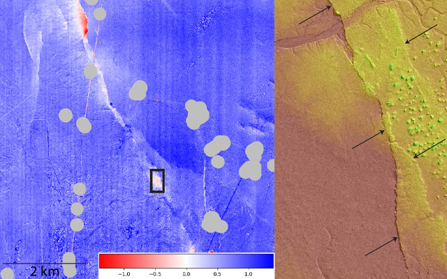
For the first time, researchers have developed a machine learning-based ensemble approach to quantify fire-induced thaw settlement across the entire Tanana Flats in Alaska, which encompasses more than 3 million acres. They linked airborne repeat lidar data to time-series Landsat products (satellite images) to delineate thaw settlement patterns across six large fires that have occurred since 2000. The six fires resulted in a loss of nearly 99,000 acres of evergreen forest from 2000 to 2014 among nearly 155,000 acres of fire-influenced forests with varying degrees of burn severity. This novel approach helped to explain about 65 percent of the variance in lidar-detected elevation change.
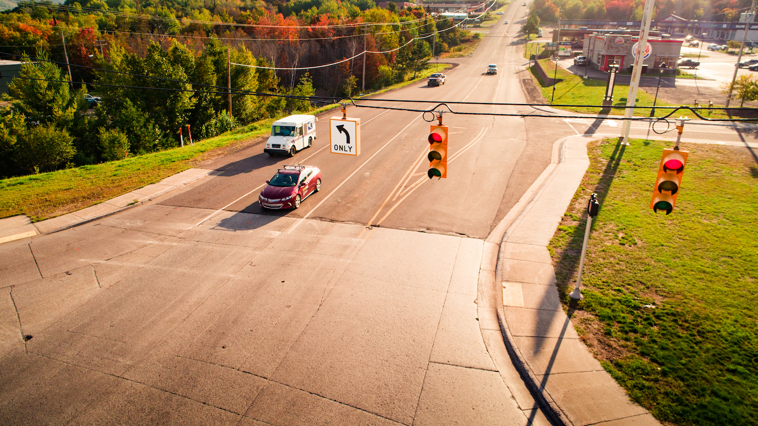
Driving in the Snow is a Team Effort for AI Sensors
Nobody likes driving in a blizzard, including autonomous vehicles. To make self-driving cars safer on snowy roads, Michigan Tech engineers look at the problem from the car’s point of view–its sensors.
Cooperative eco-driving automation improves energy efficiency and safety
Connected, automated vehicles promise to save energy and improve safety. Michigan Tech engineers propose a modeling framework for cooperative driving. Simulation results show that the cooperative automated eco-driving algorithm saves energy — 7% under light traffic and 23% under heavy traffic.
OpenTopography Collaboration Awarded New Four-Year Grant
The National Science Foundation (NSF) has renewed funding for OpenTopography, a science gateway that provides online access to Earth science oriented high-resolution topography data and processing tools to a broad user community advancing research and education in areas ranging from earthquake geology to ecology and hydrology.