
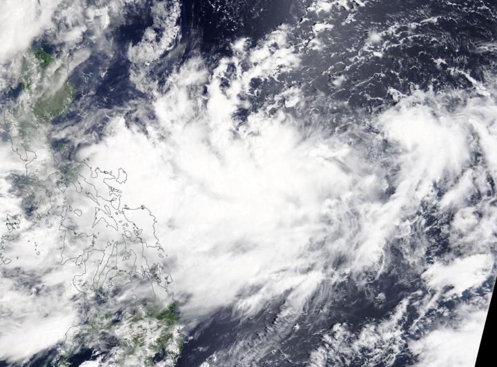
NASA’s Terra satellite passed over the Northwestern Pacific Ocean and captured an image of newly developed Tropical Depression Bailu, east of the Philippines.
On Aug. 20, 2019, the Moderate Resolution Imaging Spectroradiometer or MODIS instrument aboard NASA’s Terra satellite provided a visible image of Bailu in the Philippine Sea. The storm appeared somewhat elongated.
At 11 a.m. EDT (1500 UTC), the center of Bailu was located near latitude 15.9 degrees north and longitude 130.7 degrees east. Bailu was about 674 nautical miles south-southwest of Kadena Air Base, Okinawa, Japan. Bailu was moving to the northwest and had maximum sustained winds near 30 knots (34.5 mph/55.5 kph).
The Joint Typhoon Warning Center expects Bailu to move northwest and make landfall in Taiwan, then proceed to a second landfall in southeastern China.
###
This part of information is sourced from https://www.eurekalert.org/pub_releases/2019-08/nsfc-nft082219.php
Rob Gutro
robert.j.gutro@nasa.gov
http://www.nasa.gov/goddard

