
In 1875, Grove Karl Gilbert laid eyes on Utah’s remote and recently named Henry Mountains, and was fascinated by the “deep carving of the land which renders it so inhospitable to the travel and the settler, [but] is to the geologist a dissection which lays bare the very anatomy of the rocks.” He observed a “great depth of uplifted and arching strata”, which form domes of sedimentary rock over chambers of hardened “molten rock,” or what came to be called laccoliths.
G.K. Gilbert’s scientific exploration of the Henry Mountains led to the development of a mechanical model for mountain building that has remained valid for 150 years. In recognition of the its role in the history of geoscience, the southern Utah range has been selected as a world geoheritage site by the International Union of Geological Sciences (IUGS), along with two other features in Utah: the Great Salt Lake and Coyote Buttes, the sandstone landscape on the Arizona state line that includes The Wave.
Nominated by University of Utah geoscientists, the three sites were among the Second 100 IUGS Geological Heritage sites announced on Aug. 27 at the 37th International Geological Congress in South Korea. “These are the world’s best demonstrations of geologic features and processes,” the union said in a statement. “They are the sites of fabulous discoveries of the Earth and its history. They are sites that served to develop the science of geology.”
U research professor Marie Jackson, who mapped the three southern domes of the Henry Mountains for her doctoral dissertation in the 1980s, applauded the selection, which is a testament to G. K. Gilbert’s forward-thinking genius in the 19th century.
“This world was unexplored. These domes record raw geologic processes that were here for the viewing,” she said. “This brilliant man came to the Henry Mountains by pack mule, carefully observed and described the structures, idealized physical principles to create mechanical models and tested these models with field measurements to explain how laccolithic mountain building proceeds.”
Jackson and Marjorie Chan, both professors in the Department of Geology and Geophysics, nominated the Utah sites and compiled descriptions for the IUGS geoheritage catalog. The MSc thesis of their former U graduate student Winston Seiler is devoted to The Wave.
Additionally, three other sites just outside Utah have been recognized. The Carnegie Quarry in Dinosaur National Monument (Colorado) is one of the Second 100 sites, while the northern Snake Range in Great Basin National Park (Nevada) and the Grand Canyon (Arizona) were named in the first 100 sites in 2022. The concentration of so many wonders in the Great Basin and Colorado Plateau speaks to this region’s geological diversity and important contribution to the advancement of Earth sciences.
“It’s a combination of plate tectonics and climate and just the preservation of certain types of things. We’re just really fortunate. And what’s amazing is that we can show so many different geologic processes here,” said Chan, a former chair of the Department of Geology & Geophysics who retired this year. “Other places are covered with soil and vegetation or covered with glacial till and you can’t see much. You can see geomorphic features, but you don’t have quite as much record or exposure as we have. And the Grand Canyon was actually chosen for two particular elements, the unconformity and geomorphology.”
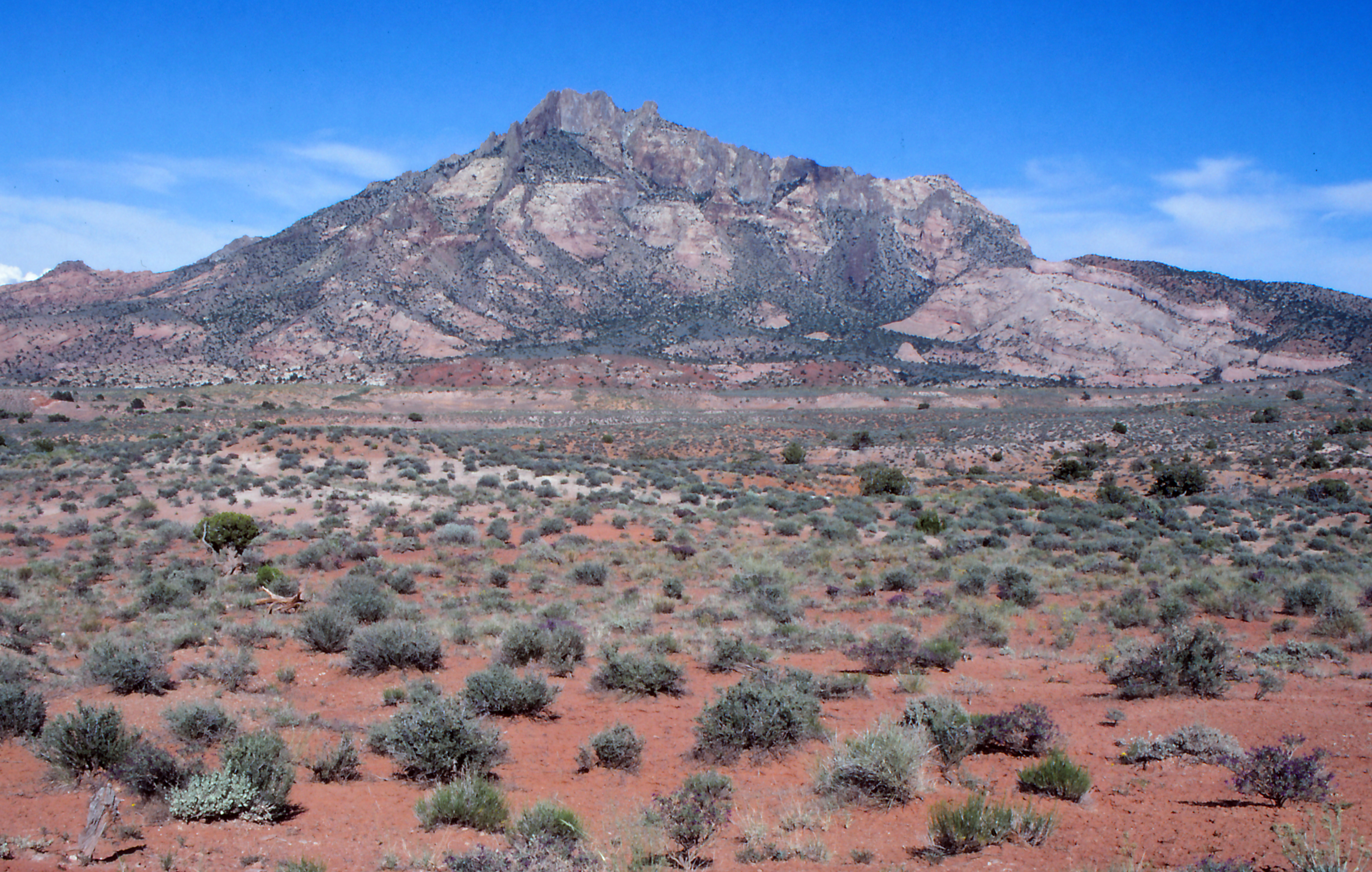
The Henry Mountains were named for physicist Joseph Henry, who served as the Smithsonian’s inaugural secretary from 1846 until his death in 1878. Of all the geoheritage sites in and around Utah, this range, the last to be named and mapped in the lower 48 states, is by far the least known.
But the Henry Mountains are hardly the least spectacular. G.K. Gilbert made the long march from Salina in 1875 and 1976. In his field notes, on a day too rainy for field work, he postulated a process whereby magma rose in a vertical dike, spread laterally as a horizontal sill, and opened a thick chamber of magma by lifting and bending the overlying strata. He gave these chambers the name “laccolite,” now laccolith.
The geological maps of Mount Holmes, Mount Ellsworth and Mount Hillers made by Marie Jackson show the laccoliths are roughly circular in plan and formed at similar depths, 3 to 4 kilometers, beneath Earth’s surface. The overlying sedimentary rock domes have similar radii, 5 to 7 kilometers, but their amplitude increases from 1.2 to 1.8 to 2.5 kilometers, respectively. They thus record snapshots in time of evolving laccolithic mountains.
Laccolithic intrusions have been recognized in the La Sal, Abajo Mountains and Pine Valley mountains in Utah and at Navajo Mountain in Arizona.
Gilbert’s monograph, “Geology of the Henry Mountains,” was published in 1877. From 1879 onwards he was a scientist at the U. S. Geological Survey. His monograph on Lake Bonneville in 1890 forms the foundation of our knowledge of Great Salt Lake.
Coyote Buttes, in contrast with the Henry Mountains, is a wildly popular hiking destination with its own Instagram feed. This area within the Vermilion Cliffs National Monument is a feature in the Navajo Sandstone, deposited in the form of wind-blown sand during the Jurassic. The formation is Earth’s largest erg, or network of fossilized dunes, preserving a record of wind direction and climate conditions.
“Vibrant iron coloration reflects the fluids that interacted within the porous sandstone,” the Utah geologists wrote in describing the site, which was selected as an example of stratigraphic processes. “The Wave and Coyote Buttes capture the convergence of coloration and the exquisite etching and enhancement of cross-bedding through modern erosion.”
The largest saline lake in the Western Hemisphere, Great Salt Lake—a remnant of the Pleistocene freshwater Lake Bonneville that once covered much of northern Utah—was selected as a geoheritage site for how it illustrates geomorphic processes. G.K. Gilbert played a key role in describing the lake in the 1890s, and this led to his formulation of the theory of isostasy, that Earth’s crust “floats” on the mantle in a position of equilibrium.
It was the growing peril the terminal lake faces that motivated Chan to nominate the Great Salt Lake, as it faces a receding water level due to water diversions and drought. “A lot of this is to try to help bring attention and visibility to these sites so that people will make more of an effort to protect them,” she said.

