Under a warming climate, wildfires in Oregon’s southern Blue Mountains will become more frequent, more extensive and more severe, according to a new Portland State University-led study. Researchers from PSU, North Carolina State University, University of New Mexico and the…
Tag: Geography
Exposure to air pollutants from power plants varies by race, income and geography
Researchers report in ACS’ Environmental Science & Technology that pollutant exposure varies with certain demographic factors.
Department of Defense grants $2.5 million toward techniques used to detect abandoned mines, tunnels
Research will focus on improved seismic data quality and detection efficiency
Rare gas find solves puzzle of Southern Africa’s soaring landscape
The discovery of gases released from deep beneath the Earth’s crust could help to explain Southern Africa’s unusual landscape, a study suggests. Scientists have long puzzled over why areas such as South Africa’s Highveld region are so elevated and flat,…
New US Army software rapidly converts live drone video into 2D and 3D maps
Software-only solution creates maps in a matter of minutes, allowing locally collected video to be processed into immediately usable geospatial products that can be fed into other mapping applications like Google Earth, ArcGIS
Knowing your neighbors may shape US household yard care practices
Income, climate also considered in assessing yard fertilization, irrigation and pesticide use
Urban development reduces flash flooding chances in arid West
Urban development in the eastern United States results in an increase in flash flooding in nearby streams, but in the arid West, urbanization has just the opposite effect, according to a Penn State researcher, who suggests there may be lessons…
When reporting climate-driven human migration, place matters
University of Arizona researchers have shown that the conversation around migration out of Central American countries should be more nuanced and based on local trends rather than regional expectations
This is what the monsoon might look like in a warmer world
Geoscientists can reconstruct the climate of the past by analysing dripstones — and they can also draw up prognoses for the future
Severity of earthquake impact may change with the seasons, study shows
The devastating impact caused by earthquakes on the local communities and environment could differ in severity depending on the season a pioneering new study on two historic earthquakes in Kazakhstan has suggested. In this study, the team which includes an…
The thrust of the problem
UC Riverside research sheds new light on earthquake that killed 9,000 people
The thrust of the problem
UC Riverside research sheds new light on earthquake that killed 9,000 people
This is what the monsoon might look like in a warmer world
Geoscientists can reconstruct the climate of the past by analysing dripstones — and they can also draw up prognoses for the future
Severity of earthquake impact may change with the seasons, study shows
The devastating impact caused by earthquakes on the local communities and environment could differ in severity depending on the season a pioneering new study on two historic earthquakes in Kazakhstan has suggested. In this study, the team which includes an…
Scientists find eternal Nile to be more ancient than previously thought
Ancient Egyptians considered the Nile river to be the source of all life. The steady northward path of the river has nourished the fertile valleys of northeast Africa for millions of years and in doing so, shaped the course of…
Scientists find eternal Nile to be more ancient than previously thought
Ancient Egyptians considered the Nile river to be the source of all life. The steady northward path of the river has nourished the fertile valleys of northeast Africa for millions of years and in doing so, shaped the course of…
Water scarcity could impact 85% of Africa by 2050, new research shows
Twenty-eight countries in Africa could face water stress or scarcity by 2050, according to research led by faculty at Binghamton University, State University of New York.
Why did the turtles cross the highway? They didn’t, but they still might be impacted
Research finds turtles are potentially cutoff by bypass through Wayne National Forest
Why did the turtles cross the highway? They didn’t, but they still might be impacted
Research finds turtles are potentially cutoff by bypass through Wayne National Forest
What we can learn from Indigenous land management
Lessons from first nations governance in environmental management
The world is getting wetter, yet water may become less available for North America and Eurasia
Plants will demand more water in the future making less water available for people
The world is getting wetter, yet water may become less available for North America and Eurasia
Plants will demand more water in the future making less water available for people
The world is getting wetter, yet water may become less available for North America and Eurasia
Plants will demand more water in the future making less water available for people
New way to date rocks
A new way to date a common mineral could help pinpoint ore deposits and improve mineral exploration globally, according to University of Queensland scientists. The researchers have identified a new reference material and used a state-of-the-art instrument to better date…
KU Leuven researchers use satellite data to calculate snow depth in mountain ranges
Bioscience engineers at KU Leuven (Belgium) have developed a method to measure the snow depth in all mountain ranges in the Northern Hemisphere using satellites. This technique makes it possible to study areas that cannot be accessed for local measurements,…
Northern peatlands may contain twice as much carbon as previously thought
New findings double potential emissions from these areas, with big implications for climate modeling
The makeup of mariculture: FSU researchers examine global trends in seafood farming
When Florida families settle down to enjoy a seafood dinner they may not realize the main dish wasn’t freshly caught in the nearby Gulf of Mexico, but rather farmed off the coast of Panama. The process of farming seafood in the ocean, known as mariculture, is a growing trend yet little is known about the trajectories of its development.
Cretan tomb’s location may have strengthened territorial claim
Understanding Prepalatial Crete
Rice irrigation worsened landslides in deadliest earthquake of 2018 finds NTU study
Irrigation significantly exacerbated the earthquake-triggered landslides in Palu, on the Indonesian island of Sulawesi, in 2018, according to an international study led by Nanyang Technological University, Singapore (NTU Singapore) scientists. The 7.5 magnitude earthquake struck the Indonesian city on 28…
Limited seed availability, dry climate hamper post-wildfire forest recovery
A lack of tree seedling establishment following recent wildfires represents a crucial bottleneck limiting coniferous forest recovery in the western U.S., new University of Colorado Boulder-led research finds. The study, which was recently published in the journal Ecological Applications ,…
Breaking data out of the silos
UCSB researchers receive NSF grant to develop spatially explicit open knowledge networks
Native American Burning Key to Rare Oak Savannas
In a recent article in Annals of the American Association of Geographers, geographers from the State University of New York (SUNY) found that Native American land use—in particular, the use of fire—was critical in shaping the distribution of oak savannas in Western New York at the end of the 1700s.
Thousands of meltwater lakes mapped on the east Antarctic ice sheet
The number of meltwater lakes on the surface of the East Antarctic Ice Sheet is more significant than previously thought, according to new research. A study led by Durham University, UK, discovered more than 65,000 supraglacial lakes using high-resolution satellite…
Academic team to be frozen in Arctic ice for historic polar expedition
Sea ice and snow cover experts support global climate study
Global warming makes it harder for birds to mate, study finds
New research led by the University of East Anglia (UEA) and University of Porto (CIBIO-InBIO) shows how global warming could reduce the mating activity and success of grassland birds. The study examined the threatened grassland bird Tetrax tetrax, or little…
Why is Earth so biologically diverse? Mountains hold the answer
What determines global patterns of biodiversity has been a puzzle for scientists since the days of von Humboldt, Darwin, and Wallace. Yet, despite two centuries of research, this question remains unanswered. The global pattern of mountain biodiversity, and the extraordinarily…
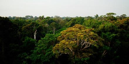
Satellite study of Amazon rainforest land cover gives insight into 2019 fires
LAWRENCE — Throughout August and early September 2019, media around the world have reported on the extensive forest fires ravaging Brazil’s Amazon rainforest. Much of the concern stems from the Amazon’s significance to regulating the world’s climate. According to the…

Research on the good life
ZiF conference on late socialist societies
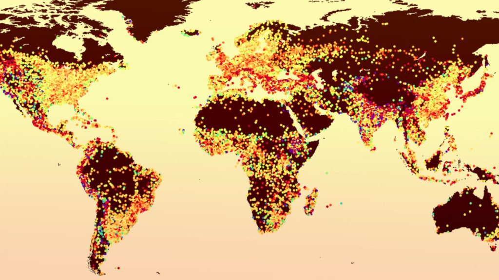
Natural ways of cooling cities
Urban heat islands are a phenomenon where the temperature in a city is noticeably higher than in the surrounding rural area. When combined with the sort of heatwave that hit many parts of Europe at the beginning of July, urban…
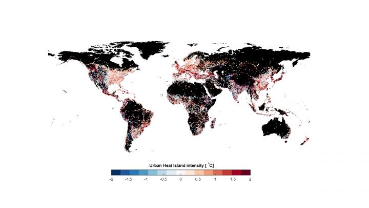
Solutions to urban heat differ between tropical and drier climes
In summer heat, cities may swelter more than nearby suburbs and rural areas. And while the size of this urban heat island effect varies widely among the world’s cities, heat island intensity can largely be explained by a city’s population…
Earthquake symmetry
Earthquake study casts doubt on early warnings but hints at improved forecasting
Snowfall frequency declining across Northwest, PSU study finds
With warming temperatures, average snowfall frequency is estimated to decline across the Pacific Northwest by 2100 — and at a faster rate if greenhouse emissions are not reduced, according to a new Portland State University study. Researchers in PSU’s Climate…
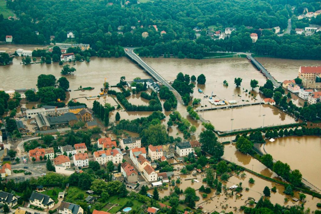
Floods are impacted by a changing climate
A large international research project led by the Vienna University of Technology has demonstrated,
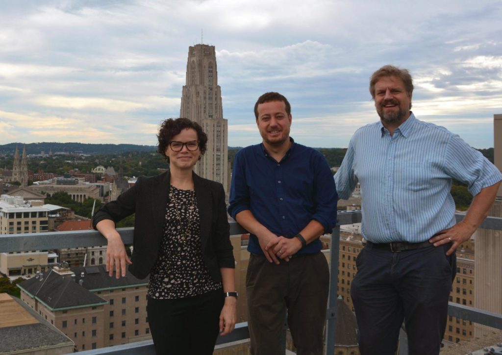
Using nature to protect cities from extreme weather
Pitt and Northwestern awarded $2 million by NSF to study nature-based strategies to prevent urban fl

Using nature to protect cities from extreme weather
Pitt and Northwestern awarded $2 million by NSF to study nature-based strategies to prevent urban fl

Crack in Pacific seafloor caused volcanic chain to go dormant
UH geologists discover 10 million years of silence