Since 2014, Zhang has been working on a NASA project that allows scientists to track the growing season globally—for free. Zhang develops remote-sensing algorithms and computing code that make the data available to scientists through the NASA land surface phenology product. A new version was publically released in July 2020 through the land processes distributed active archive center, a partnership between the U.S. Geological Survey and NASA.
“This is one of the most reliable, consistent data records with which to do scientific research on climate change and the environmental impact of human activity,” said Zhang, who has received nearly $1.4 million funding for the project. Three postdoctoral researchers and two doctoral students have also worked on the NASA project.
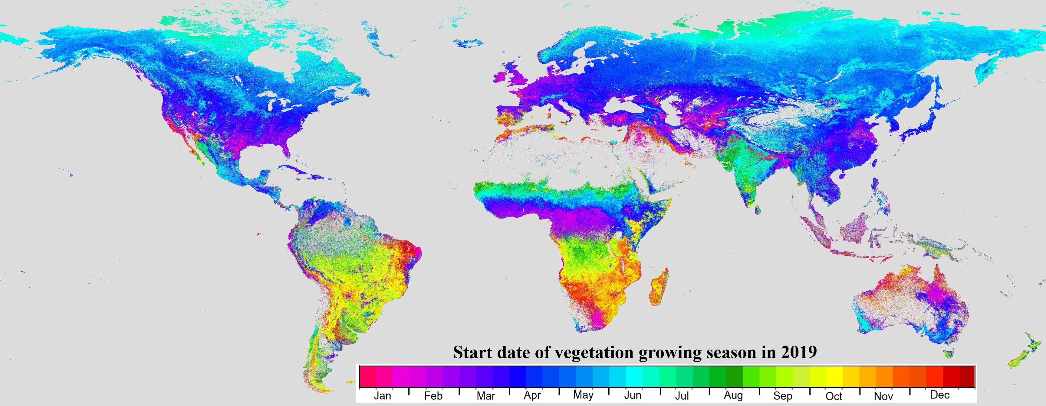
Vegetation phenology refers to the timing of the developmental stages of plant life cycles. That can mean anything from when a tree begins to leaf to when a soybean crop dries so it can be harvested. The NASA phenology product can track, not only when plant growth begins, but also when and where drought and plant disease outbreaks occur, Zhang explained.
Climatologists and meteorologists use the phenology data in their forecasts, he pointed out. “Seasonal vegetation greenness changes influence surface energy variables that, in turn, impact weather modeling and also affect hydrological conditions.”
The NASA phenology product uses data from the visible infrared imaging radiometer suite, or VIIRS, aboard the Suomi National Polar-Orbiting Partnership satellite, which was launched in October 2011, and the Joint Polar Satellite System satellite, which was launched in November 2017. The sensor suites produce digital images composed of pixels that measure energy reflected from the Earth surface. Each pixel captures energy readings from a 500-meter area on the Earth’s surface.
The VIIRS phenological data allows scientists to track up to two growing cycles per year globally beginning in 2012, Zhang explained. Plans to launch three more JPSS satellites between 2022 and 2031 means scientists will have a reliable data source for the next few decades.

