NASA’s Terra satellite passed over the northwestern Pacific Ocean and provided a final view of Tropical Depression Peipah.
Peipah developed on Sept. 14 as a depression. It was the seventeenth (17W) tropical depression of the Northwestern Pacific Ocean typhoon season. On Sept. 15 at 11 a.m. EDT (1500 UTC) the depression strengthened into a tropical storm with maximum sustained winds near 35 knots (40 mph) and was renamed Peipah. On Sept. 16, Peipah weakened back to a depression.
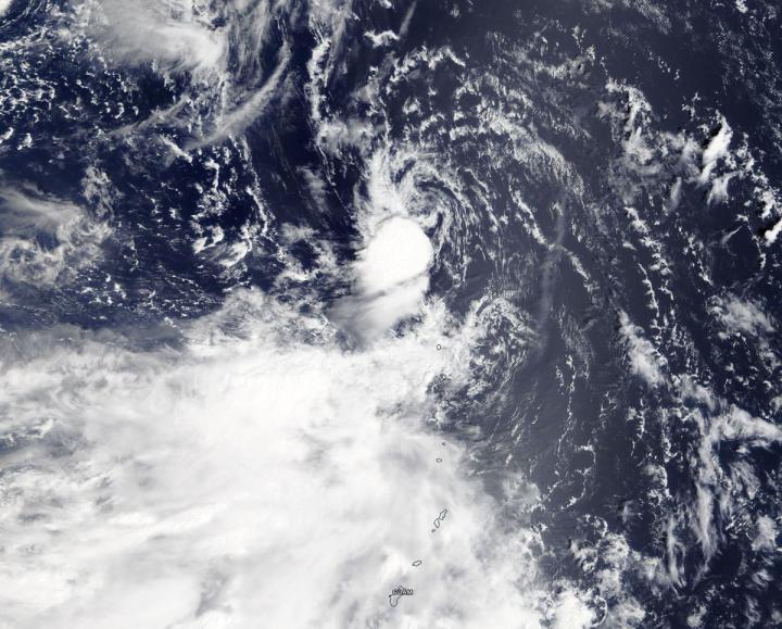
On Sept. 16, the Moderate Resolution Imaging Spectroradiometer or MODIS instrument aboard NASA’s Terra satellite provided a visible image of Peipah. The storm had diminished to a swirl of clouds, with only a small area of strong thunderstorms southwest of the center. Wind shear from the northeast pushed those storms southwest of center.
In general, wind shear is a measure of how the speed and direction of winds change with altitude. Tropical cyclones are like rotating cylinders of winds. Each level needs to be stacked on top each other vertically in order for the storm to maintain strength or intensify. Wind shear occurs when winds at different levels of the atmosphere push against the rotating cylinder of winds, weakening the rotation by pushing it apart at different levels.
Tropical Depression Peipah was dissipating on Sept. 16 at 11 a.m. EDT (1500 UTC). It was centered near 24.8 degrees north latitude and 142.8 degrees east longitude, about 82 miles east of Iwo To Island, Japan. Peipah was moving to the northwest and had maximum sustained winds near 25 knots.
The Joint Typhoon Warning Center issued their final warning on the system as it continued to dissipate.
###
By Rob Gutro
NASA’s Goddard Space Flight Center
This part of information is sourced from https://www.eurekalert.org/pub_releases/2019-09/nsfc-h091619.php
Rob Gutro
[email protected]
http://www.nasa.gov/goddard

